Red Rock Canyon State Park is just off Interstate Highway 40, about 5 miles south of Hinton Oklahoma. My wife and I visited there on our way back from Oklahoma City recently. It is an interesting place to visit because of its geology and scenery. There are places for visitors to camp and explore while in the park. The Plains Indians used this canyon as a winter campsite and settlers on the “California Road” would visit for fresh water and a place to camp, too. (Wikipedia)

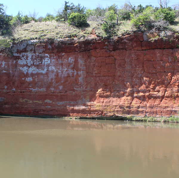
The canyon that forms the park has been cut by a tributary of Sugar Creek which flows into the Washita River. Red Rock Canyon is formed from the Rush Springs Sandstone which is a formation that is about 300 feet thick. This formation was deposited in the late Permian era about 270-250 million years ago. The sediments were eroded from the Ouachita mountains to the east and the Rockies to the west. 150 feet of this formation is exposed in the park, and the actual floor of the canyon is 20 to 50 feet below the alluvial sediments that visitors see, walk, and drive upon.
The flow of Sugar Creek is provided by local runoff from the surrounding land and by natural springs and seeps from the porous sandstone. The park is occasionally closed when flooding occurs.

The erosional processes that have produced this canyon are believed to have started during the Pleistocene period. Geologists disagree about how long these processes took to form the canyon. Some say it has taken a million years and others think it has only taken 115,000 years.
If you are interested in more detail about the geologic history of the park, you can read a 1996 article by Neil Suneson and Kenneth Johnson that expands upon what I have quoted from them here.
Leave a Reply