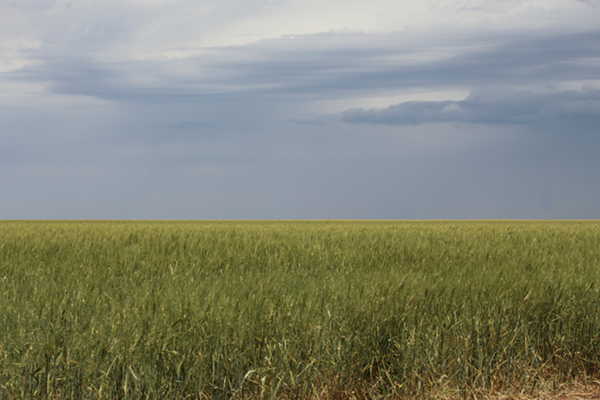
I live in an interesting part of Texas. We are on the edge of the Great Plains escarpment, known locally as the caprock. The caprock is great farmland, miles and miles of flat land. Pictured here is a winter wheat field. Cotton is king in these parts, but folks also grow corn, pumpkins, canola, and hay. Beef production is a big part of the economy around here too.
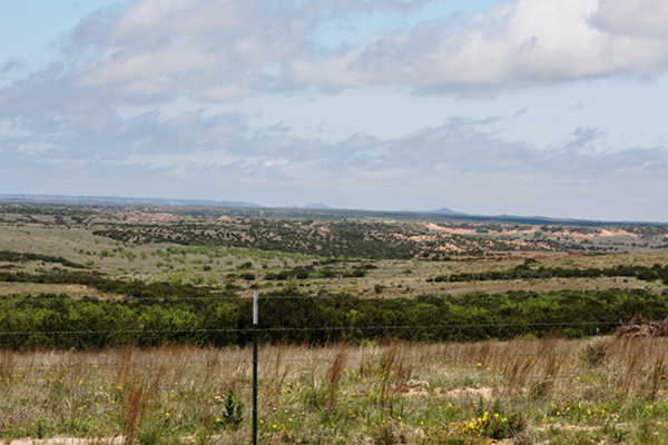
This image is looking north from a place just west of my town. The elevation up on the caprock is about 3133 above sea level and drops to 2450 feet near Matador and declines even further as you go east and south from here.

This image shows an exposed piece of the caprock on the center right. In the center left the dark green is the bottom of the canyon. Between there and the top of the canyon is over 600 feet of elevation change. The caprock is part of the Ogallala formation which is about 10 million years old. The rocks at the bottom of the canyon are Permian age rocks that were deposited some 298 to 250 million years ago.
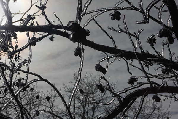
Erosional forces have been at work all this time to produce the terrain we see today. Ice during the winter can cause stones and soil particles to loosen, which opens the way for water or wind to move them.

As you can see, this country is rough along the edges of the caprock also known as the Great plains Escarpment(seen here at the horizon).
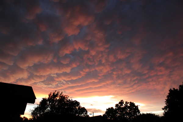
Our semi-arid climate while great for growing cotton, is sometimes prone to large thunderstorms.
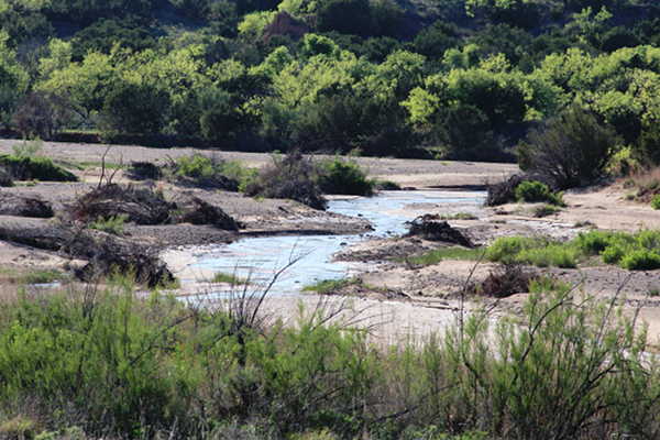
We have many creeks and rivers that run through this part of the world. They are what geologists call intermittent streams. They may be dry one day and full of water the next. This is a picture of the North Pease River on a day it had water flowing. The Pease has 3 branches in our area.
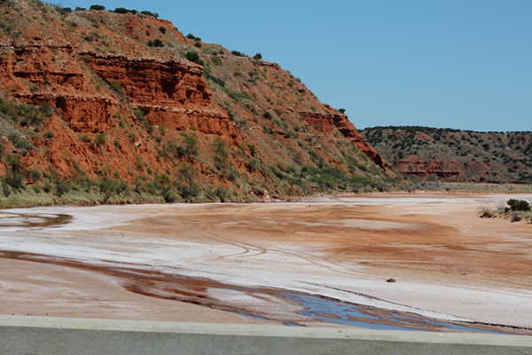
Here is a shot of the Little Red River. A lot of water can flow through here when needed. It is dry most of the year. The cliff on the left of the picture shows strata that were deposited during Permian times. A lot of rock and soil from these formations have washed down this river.
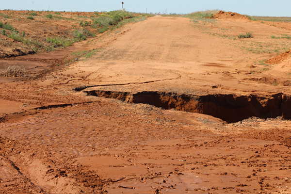
This is an example of a washed out county road. The surface of this dirt road had been coated with some black-top here to protect it from erosion by rain water. The land here is very sandy and the runoff from the surrounding fields comes through here and empties into a creek about 10 feet below the road surface. As you can see, the drainage from a heavy rainstorm cut back into the soil and undermined the road. This is an example of the kinds of erosional forces at work which have produced the terrain we see today.
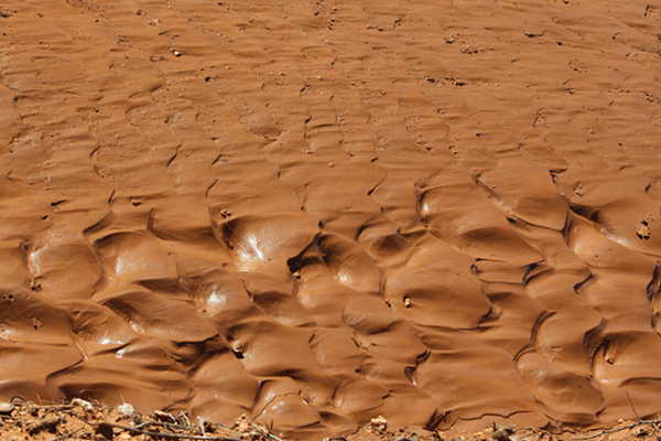
This is what water running down a sandy hillside can do to the surface of the soil.
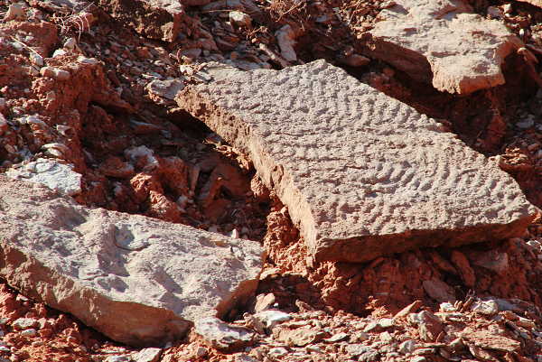
Compare the ripples in the Permian age mudstone pictured here to the previous image. It is one of the ways that geologists try to explain what they see in the rocks they study. We have a current example of how running water can shape the surface of soils and and ancient example of the same kind of behavior. So, it is possible to infer that the ancient example was created in a similar fashion.
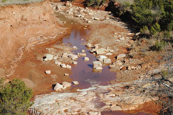
Here is another example of how powerful moving water can be. In the center of the photo are large chunks of limestone that have been eroded from the hills upstream and pushed along its course. Notice the large white ledge of limestone in the foreground. Its overlying sediments have been washed away. These are Permian age rocks(over 250 million years old).
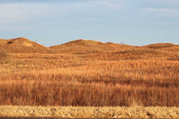
What you see here is a series of hills covered with grassy vegetation. The hills are primarily made of sand. The grasses help to keep these dune-like piles of sand from being blown away. One thing we have lots of, in the high plains of Texas, is wind.
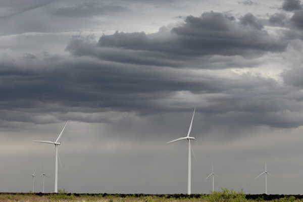
My part of Texas is beautiful, ancient, and modern. You can see over 250 million years of time written in the rocks of this country. We are also the location of one of the largest concentrations of wind generators in the world. The rugged beauty of this part of Texas makes my job easy as a photographer because I can always find something interesting to share with you.
Leave a Reply